Google has released Google Earth 6 that offers users more functionality, including tighly integrated Street View, historical imagery and 3D trees to make the web service more realistic.
Google Earth is the search engine’s digital atlas, allowing users to search for places all over the globe and see satellite views of the sky, geographical terrains and ocean landscapes. It’s also one of the rare apps Google offers as a download for users’ desktops.
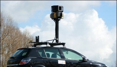
Google added its Street View street-level imagery to Google Earth in 2008. While Street View has suffered significant privacy hiccups after the company’s cars snatched 600 gigabytes of users’ data from WiFi networks, it remains a vital part of Google’s effort to make locations searchable on Google Maps and Google Earth.
To this point, Google Earth users have been able to “fly into” Street View panoramas similar to the way they could visit other parts of earth and sea.
Users may “pick up Pegman and drop him wherever you see a highlighted blue road to fly right down to the ground,” according to Google Earth Product Manager Peter Birch.
Users may then use the scroll-wheel on their computer mouse or the arrow keys on their desktop keyboard to navigate streets in Earth 6.
Those who want to visit a place farther away can click “exit” button to return to an aerial view and pick their next destination.
Google also added more than 80 million 3D trees, spanning 50 species, across Athens, Berlin, Chicago, New York City, San Francisco and Tokyo. Users must switch on the 3D buildings layer on the left side panel to see the trees.
Finally, Google spruced up its historical imagery, which allows users to see scenes from Warsaw in 1935, London in 1945, and Port-au-Prince Haiti before and after the devastating earthquake of January 2010.
While locating historical images was a wish-and-hope game when it appeared with Google Earth 5, when users fly to an area where historical imagery is available in Google Earth 6, the date of the oldest imagery will appear in the status bar at the bottom of the screen.
Users may click on this date to be taken back in time to view imagery from that time period.
These improvements are typical of Google’s evolution of its web services, but fleshing out Earth and integrating Street View may set the company up to provide local advertising atop Street View images in the future.
Google’s geolocation team has a desire to add augmented reality to its digital imagery tools, dropping real life over Street View images.
Escalation of feud between Sam Altman and Elon Musk, after OpenAI confirms it is now…
Report from International Energy Agency (IEA) warns AI is set to drive surging electricity demand…
First launch of Amazon's Project Kuiper internet satellites pushed back amid “stubborn” cloud cover, heavy…
As Trump eases his global tariffs, but ramps up China's input duty, Apple reportedly airlifts…
Expansion among chaos. Amazon considering warehouse expansion in US, and already cancelled some Chinese orders